Montafon Verwall round route


Tour description
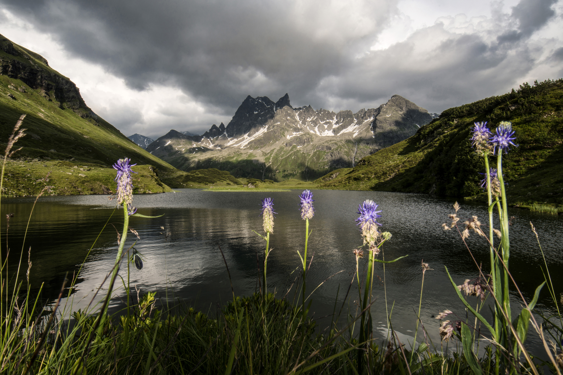
The Montafon Verwall round route leads through the Verwall European protected area between the valley floor of the Litz and the high peaks of the Verwall group. A refuge for rare birds and animals as well as for long-distance hikers who like to travel off busy paths. The lakes, moors, dwarf pine and pine forests at the transition from the marginal to the central Alps and the views of the peaks are mostly enjoyed alone.
Approach
Coming from Bludenz, you drive through Schruns and on the federal road towards Silbertal until you reach the Kristbergbahn.
If you arrive by car, keep in mind that this route ends in Gaschurn. However, you can take the bus from Gaschurn to Schruns and then transfer to the bus to Silbertal.
Public transport
accessible by train and bus
The Montafon train runs to Schruns. From here, take the bus to Silbertal.
Directions
Stage 1: Silbertal to Neue Heilbronner Hut
The starting point of this route is at the Kristbergbahn in Silbertal. From here, you can either take the hiking bus to the Lower Gaflunaalpe or walk directly from Silbertal on foot. However, the first stage is very long and you should have very good fitness.
From Silbertal, you follow the path into the rear Silbertal. The path passes the Fellimännle inn to the Lower Gaflunaalpe. From here it continues deeper into the rear Silbertal. At the upper Freschalpe, you continue to the Langsee.
After a short break at Langsee, the path leads you into the Schönverwall. Here you go right up to the Verbellner Winterjoch. Above the Scheid lakes you will find the Neue Heilbronner Hut.
Walking time approx. 7:45 hrs // approx. 24 km // ascent 1,493 m, descent 64 m
Stage 2: Neue Heilbronner Hut to Gaschurn
The next morning, the next stage starts at the Neue Heilbronner Hut and leads you down to the Verbellaalpe. Before the Verbellaalpe, you cross the alpine road and take the path that leads over the beautiful alpine meadow towards the Wiegensee.
After a short rest at Wiegensee, the path continues to the Inner Tafamuntmaisäß. Here you will find the Alpstöbli for a small refreshment.
Well rested and fortified, you start the last section of this day stage towards Gaschurn. The path leads you past the Outer Tafamuntmaisäß down into the center of Gaschurn.
Walking time approx. 4 hrs // approx. 12.7 km // ascent 77 m, descent 1,405 m
Equipment
good, ankle-high mountain boots with good grip, sufficient provisions and drinks, hiking poles recommended
Tips
I recommend the first part with the hiking bus "Hinteres Silbertal", as this shortens the route by 8 km or 2.5 hours.
Infos www.montafon.at/wanderbus
Camping in the Verwall European protected area is not allowed!
Even if they are often the most scenic areas: Camping is generally prohibited in protected areas. Therefore, camping is not allowed on this circular route.
Destination
Gaschurn, center
Starting Point
Silbertal, center
Sicherheitstipps für Wandern in Vorarlberg
EN NOTRUF:
EN 140 - Alpine Notfälle österreichweit
EN 144 - Alpine Notfälle Vorarlberg
EN 112 - Euro-Notruf (funktioniert mit jedem Handy/Netz)


